

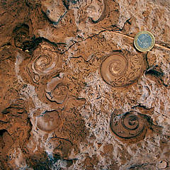
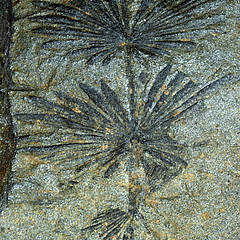
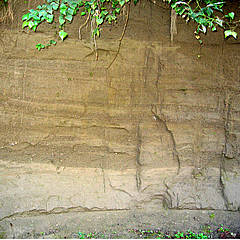
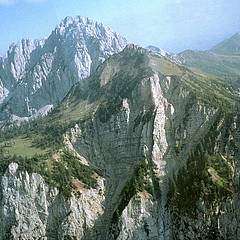
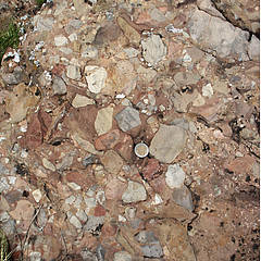
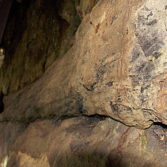
I geotopi sono formazioni storiche della terra di natura inanimata che forniscono informazioni sullo sviluppo della terra e della vita. Essi comprendono fossili, minerali, rocce, terreni e intere sezioni di paesaggio come le torbiere.
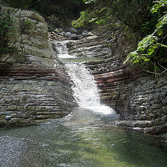
Nel GeoParco delle Alpi Carniche sono stati definiti finora circa 81 geotopi. I geotopi sono suddivisi in punti di sosta (ad esempio Zollnersee), punti di conoscenza (ad esempio Cellonrinne) e punti per persone attive (ad esempio Kellerwand o Garnitzenklamm).
La mappa panoramica nella sezione "Mappa dei geotopi" mostra la posizione dei singoli geotopi e fornisce informazioni sui punti in modo semplice (con un clic del mouse). È anche possibile scaricare questa mappa per stamparla.
Qui troverete le descrizioni degli approcci e brevi informazioni di base sui singoli geotopi del GeoParco delle Alpi Carniche.
Geotopes are geological documents of the so-called abiotic world which provide insights into the history of the Earth and the development of life. They comprise fossils, minerals, rocks, soils and other parts of the landscape like, e.g., bogs.
To date, within the GeoPark some 81 spots are defined as Geotopes. They are subdivided into areas for relaxing (e.g. Lake Zollner), as knowledge spots (e.g. Cellon avalanche gorge) and in places where some activity is needed (e.g. Kellerwand Cliff or Garnitzen Gorge).
The general view in the link „Geotope map“ reveals the exact position of individual Geotopes and provides pinpoint informations. In addition, this map can be downloaded and printed.
A comprehensive description of most of the following Geotopes can be found in the illustrated book by Hans P. Schönlaub „Der wahre Held ist die Natur“.
Below you will find hints to access the Geotopes supplemented by some further informations of individual Geotopes in the GeoPark Carnic Alps.
Geotope 1: Weißensee
Geotope 2: Bodensee
Geotope 3: Grünsee and Valentinsee
Geotope 5: Lake Promosio (Promossee)
Geotope 6: Lake Wolayer
Geotope 7: Vorderberg Gorge
Geotope 8: Garnitzen Gorge
Geotope 9: Weißenbach Gorge
Geotope 10: Mauthen Gorge
Geotope 11: Mühlschuss - St. Lorenzen/Gitschtal
Geotope 12: Gössering
Geotope 13: Noelbling Creek
Geotope 14: Hilden Fall
Geotope 15: Million Waterfall
Geotope 16: Nölbling Waterfall
Geotope 17: Weidenburg Waterfall
Geotope 18: Nötsch Badstuben
Geotope 20: Feistritz Alm
Geotope 21: Krone
Geotope 22: Nieselach
Geotope 23: Garnitzen Saddle
Geotope 24: Kammleiten
Geotope 25: Gugga
Geotope 26: Garnitzenhöhe 1
Geotope 27: Garnitzenhöhe 2
Geotope 28: Auernig
Geotope 29: Peak of Trogkofel
Geotope 30: Rattendorf Crest
Geotope 31: Roßkofel
Geotope 32: Paßriach Pit
Geotope 33: Waidegg Höhe
Geotope 34: Stranig Alm Road
Geotope 35: Gundersheim Alm Road 1
Geotope 36: Gundersheim Alm Road 2
Geotope 37: Zollner - Collendiaul 1
Geotope 38: Zollner - Rösser Hut
Geotope 39: Zollner - Zollner See Höhe 1.813 m
Geotope 40: Obere Bischofalm
Geotope 41: Gailbergmoor
Geotope 42: The petrified forest
Geotope 43: Casera Malpasso
Geotope 44: Casera Valbertad bassa
Geotope 45: Großer Pal
Geotope 46: Grüne Schneid
Geotope 47: Stelzling Hut
Geotope 48: Valentintörl
Geotope 49: Rauchkofel-Boden 1
Geotope 50: Rauchkofel-Boden 2
Geotope 51: Wolayer Valley 1
Geotope 52: Wolayer Valley 2
Geotope 53: Radegrundgraben
Geotope 54: Kellerwand
Geotope 55: Reppwand
Geotope 56: Findenig-Nordwand
Geotope 57: Reißkofelrinne
Geotope 58: Polinik Northern Cliff
Geotope 59: Gartnerkofel Southern Wall
Geotope 60: Cellonetta Avalanche Gully
Geotope 61: Geotrail Wolayersee
Geotope 62: Geotrail Plöckenpass
Geotope 63: Kristallwelt Gailschlucht
Geotope 64: Geo-Mining St. Daniel
Geotope 65: Nölbling Creek
Geotope 66: Gail-Rafting
Geotope 68: Geotrail Zollnersee
Geotope 69: Stranig Creek
Geotope 70: Roßkofel - Geo-Caving
Geotope 71: Geotrail Naßfeld
Geotope 72: Garnitzen Gorge - Canyoning
Geotope 73: Geotrail Garnitzenklamm
Geotope 74: Terra Mystica
Geotope 75: Geolehrpfad Dobratsch
Geotope 76: Lower Valentinalm
Geotope 77: Upper Valentinalm
Geotope 78: Rösser Hut
Geotope 79: Mussen/Schatzbichl - Girlande Soil
Geotope 80: Mussen/Schatzbichl - Lamellar Soil
Geotope 81: Egger Alm
 |
 |
 |
 |
 |
 |
 |
 |
 |
 |